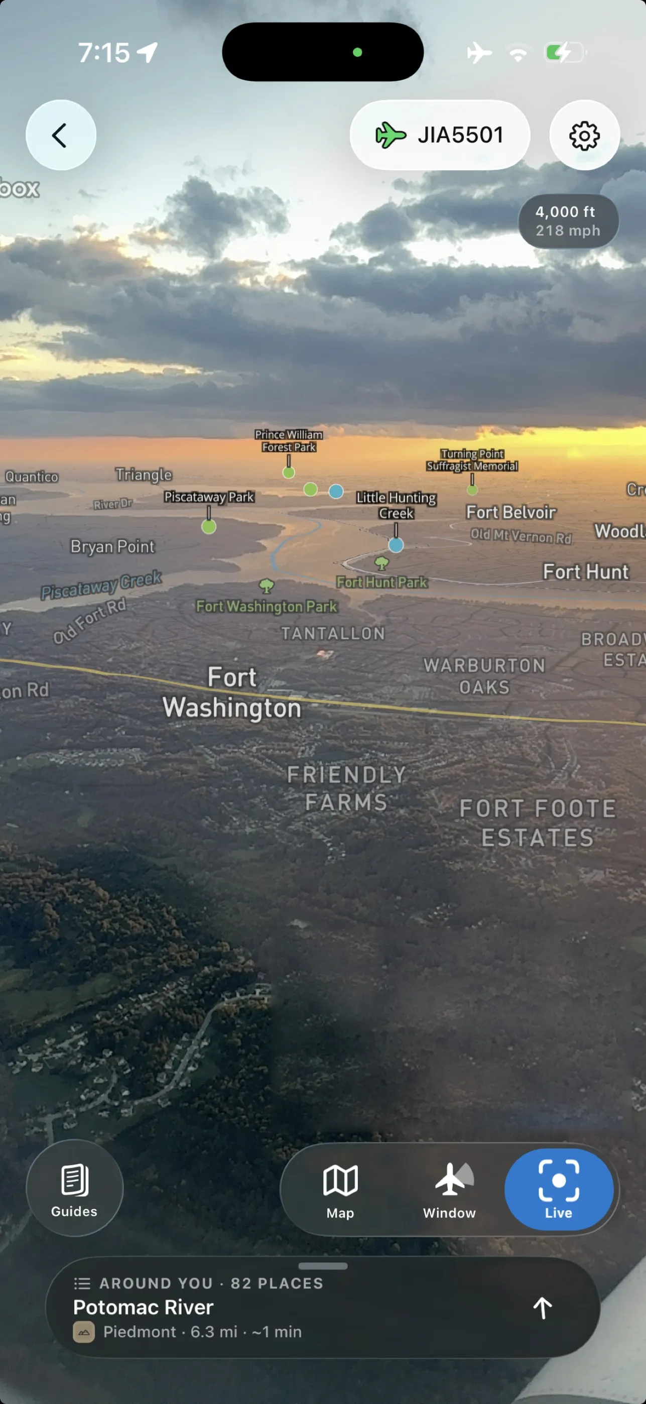
Save your flight before takeoff, and at cruising altitude in airplane mode the app draws names over what is actually outside the window — rivers, parks, glaciers, the neighbourhood whose lights you are looking at — and when there is nothing but cloud, it tells you about the cloud.
Shane Loeffler was a geology graduate student at the University of Minnesota when the idea arrived on a flight in 2014: he could read the landforms below, and nobody else on the plane could. With Amy Myrbo at the university’s lake-core facility and a National Science Foundation grant, the first Flyover Country shipped in December 2015. You typed a start and an end, and it downloaded the geology from Macrostrat, fossil sites from the Neotoma and Paleobiology databases, and everything else from Wikipedia, so the whole thing worked without in-flight Wi-Fi.
In 2016 Loeffler told Outside what he wanted next: a mode that used the phone’s sensors to identify landmarks directly, “as long as the compass sensors in phones aren’t too confused by the plane’s fuselage.” Then the app went quiet. The Show HN post this week calls it “our long abandoned app,” and says it has been rebuilt from the ground up — and the sensor mode is the thing that finally shipped.
Hold the phone to the window in Live view and it projects roads, map labels and satellite imagery onto the camera so you can line the overlay up with the ground; tap a label to read about it. After dark it blends the map with the lights, which is how you tell an airport from a suburb. The 3D map shows the shape of the land along the route with a preview of what is coming, and a “Left window” toggle so it draws the side you are on. Before you fly, you choose what to save — satellite imagery, 3D terrain, article images — with the download size shown up front. And when the ground is hidden, a set of illustrated guides explains the difference between a wispy cirrus and a blanket of stratus, so the cloud becomes the view.
The honest caveats are the developer’s own. The rebuild is weeks old, the release notes ask for bug reports, and the Show HN post admits this is “a tough app to test for obvious reasons” and asks anyone who tries it in the sky to email. The 2016 reviews noted that a pilot’s weather diversion could carry you away from the corridor you downloaded, and nothing about the rebuild changes that. The university project is now a small company, Flyover Country LLC, but the price has not moved: free on iPhone (iOS 16.4 or later, 127MB) and Android, with no ads and a Play listing that declares no data collected, and the flight you save works with the radio off.