Twenty-one maps, one uniform scale, and a single device: everything a given age had not yet found lies buried under engraved black cloud, which draws back plate by plate until there is nothing left to lift.
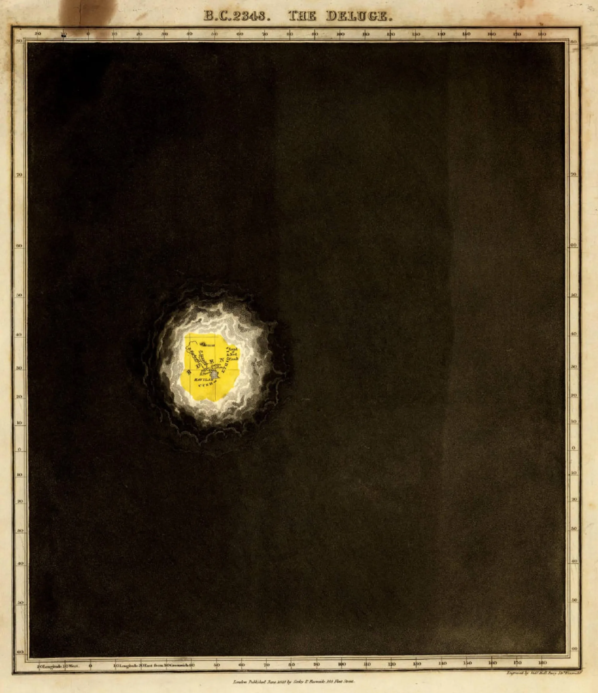
The first plate is dated B.C. 2348 and titled The Deluge, and it is almost entirely dark — a field of aquatint the colour of a wet slate roof, with one ragged hole burned through it above Mesopotamia. Inside the hole sits a lozenge of hand-coloured yellow about the size of a thumbprint, lit white at the edges where the cloud curls away from it: Eden, the Land of Nod, Mount Ararat, Havilah, Cush, the Euphrates and the Tigris drawn in as thin as hairs. Longitude and latitude are ruled and numbered all the way around the border, degree by degree, on a sheet that shows nothing else.
Quin’s preface explains the device, and the reasoning is sharper than the gimmick suggests. Maps captioned “the world as known to the ancients” already existed; he wanted a whole run of them, and hit a problem. “China and America were as much in existence in the days of Cyrus as they are now,” he writes, “although unknown to the great mass of civilized human beings.” Leaving them off would be false; drawing them in would be equally false. “The only course left to us seemed to be, to bring the appearance of a cloud over the skirts of every map… lifting up or drawing off this cloud as the limits of the known world gradually extended.”
Sidney Hall engraved it as actual weather. By A.D. 1498 the cloud has broken into banks with sunlit edges streaming diagonally across the sheet, Europe’s empires are pinpricks of red and green, and the eastern shore of America is a lit strip at the far right. At A.D. 1660 there is still a wall of black over the Pacific, the Arctic and the Great Southern Ocean. The scale never changes — a territory once drawn keeps the same size in the same spot forever — but the paper does: the first fifteen plates are upright pages, and from the discovery of America the last six are wide folding sheets. The book has to open further once the world gets bigger.
The cloud is only half the shading, and the other half is the part worth knowing. Places Europeans knew of but did not credit, Quin covered “alike in all the periods, with a flat olive shading”, his empire colours being “obviously inapplicable to deserts peopled by tribes having no settled form of government”. Scythia gets it throughout antiquity; the interior of Africa gets it, in his words, “at the present moment”. So the last plate, A.D. 1828, has a clear sky over the entire earth — and inland Africa, Arabia, central Australia and much of western North America sit in flat, unlettered olive-brown. The cloud lifts. The tint never does.
Quin was a barrister who did this on the side, and he never saw it bound: the plates carry a June 1828 imprint, he died that year at thirty-four, and the atlas appeared in 1830. It outlasted him by decades — reprinted through the 1830s, then redrawn and rescaled in 1846 by William Hughes, who discarded Quin’s text altogether. All twenty-one plates are scanned by the David Rumsey Map Collection and free to download; the Public Domain Review’s selection runs nineteen of them, skipping the 1783 and 1811 periods. Rumsey’s own viewer goes to full resolution, which on the Deluge plate is 4,179 pixels across — enough to read the word EDEN inside the hole.