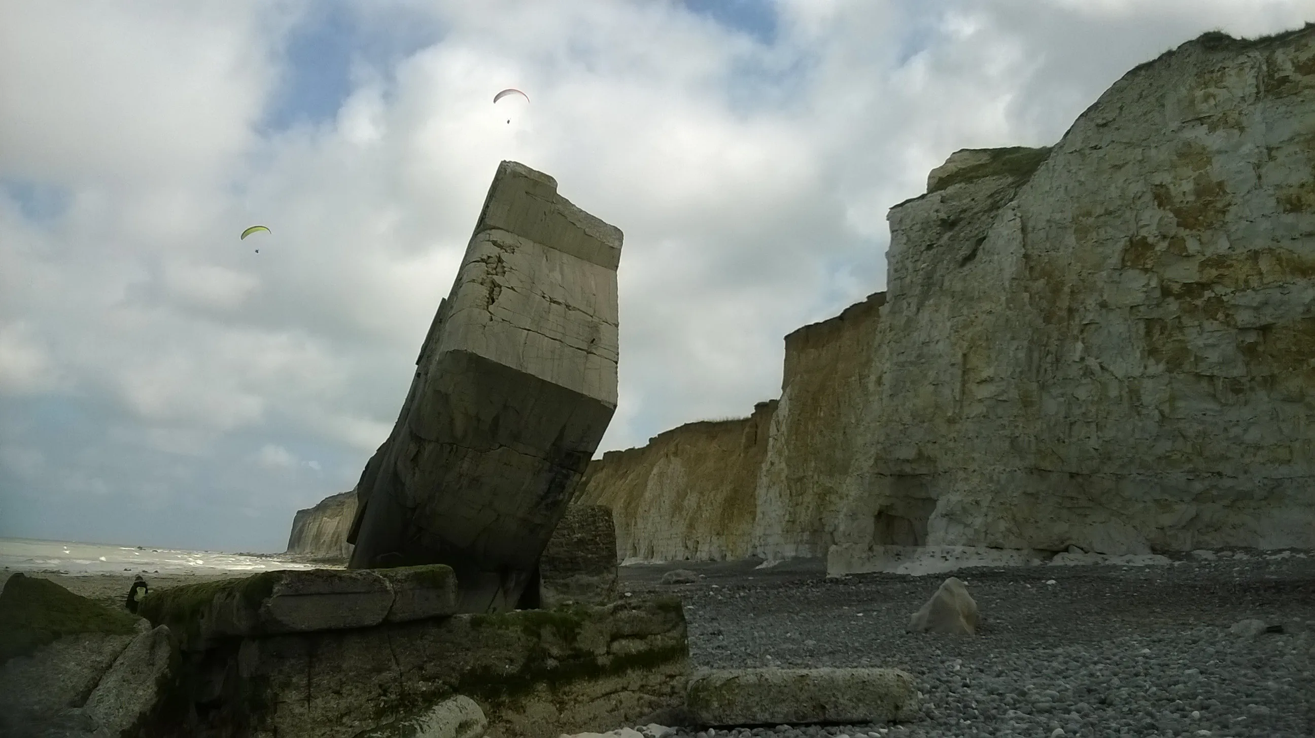
The bunker below the cliffs at Sainte-Marguerite-sur-Mer, April 2017. Photo by Patrice78500, via Wikimedia Commons — CC BY-SA 4.0.

It is usually told as a bunker that fell off a cliff. It didn’t. Erosion left this 1,650-tonne block hanging over the beach at Sainte-Marguerite-sur-Mer, and in April 1995 the Dieppe fire brigade spent a day washing the ground out from under it.
The Germans poured it in 1942, ten kilometres west of Dieppe, as a Regelbau 621 — a catalogue design, a shelter for an infantry section rather than a gun position. The Atlantic Wall was built that way, to standard drawings, by the thousand. Nothing about this one was distinguished until the chalk under it started to go.
By 1994 it was overhanging, and a hazard to anyone walking below. The commune asked the Dieppe fire service to bring it down. Explosives were off the table, so the sappers dug out its base and turned their hoses on it: water works into the seam between soil and chalk, and the collapse follows somewhere between half an hour and four hours later. Everyone expected it to shatter — the same job at Dieppe scattered concrete over 300 metres. Instead it slid, slowly, and planted itself nose-first in the shingle. It is not perfectly upright, whatever the photographs suggest. It leans, like a tooth pulled with the root still on it.
It landed at the foot of the cliff. The cliff is now about thirty metres behind it. Seine-Maritime’s chalk retreats 20 to 30 centimetres a year on average, and it does that in lurches rather than increments; Sainte-Marguerite-sur-Mer is one of 126 communes listed by decree in April 2022 as a national priority for coastal-erosion planning. So the bunker has become an accidental survey marker — a dated object set on the beach in 1995, with the coastline visibly walking away from it.
In 2017 Agnès Varda and JR came here for Visages Villages. Varda had a photograph she took in 1954 of her friend Guy Bourdin, later a fashion photographer, then a young man sitting with his legs straight out in the window opening of a ruined house nearby. She wanted it pasted on some new-built houses. JR looked at the bunker instead and put it there, tilted to match the concrete’s own angle, so the block reads as a cradle with someone asleep in it. It lasted one tide. The next day, after the sea had been and gone, the paper was off.
The beach is shingle at the mouth of the Saâne, and the bunker is a walk along the foreshore beneath the cliff. That cliff cannot be climbed, and at high water the sea comes right to its foot. Check the tide table before you set out and go on the ebb — the difference between an hour’s walk and a call to the lifeboat is arithmetic you do in advance.